
: failed to open stream: Invalid argument in <b>/home/servuzmq/minisites/siteT1/common/template/carteV2.php</b> on line <b>139</b><br />
)
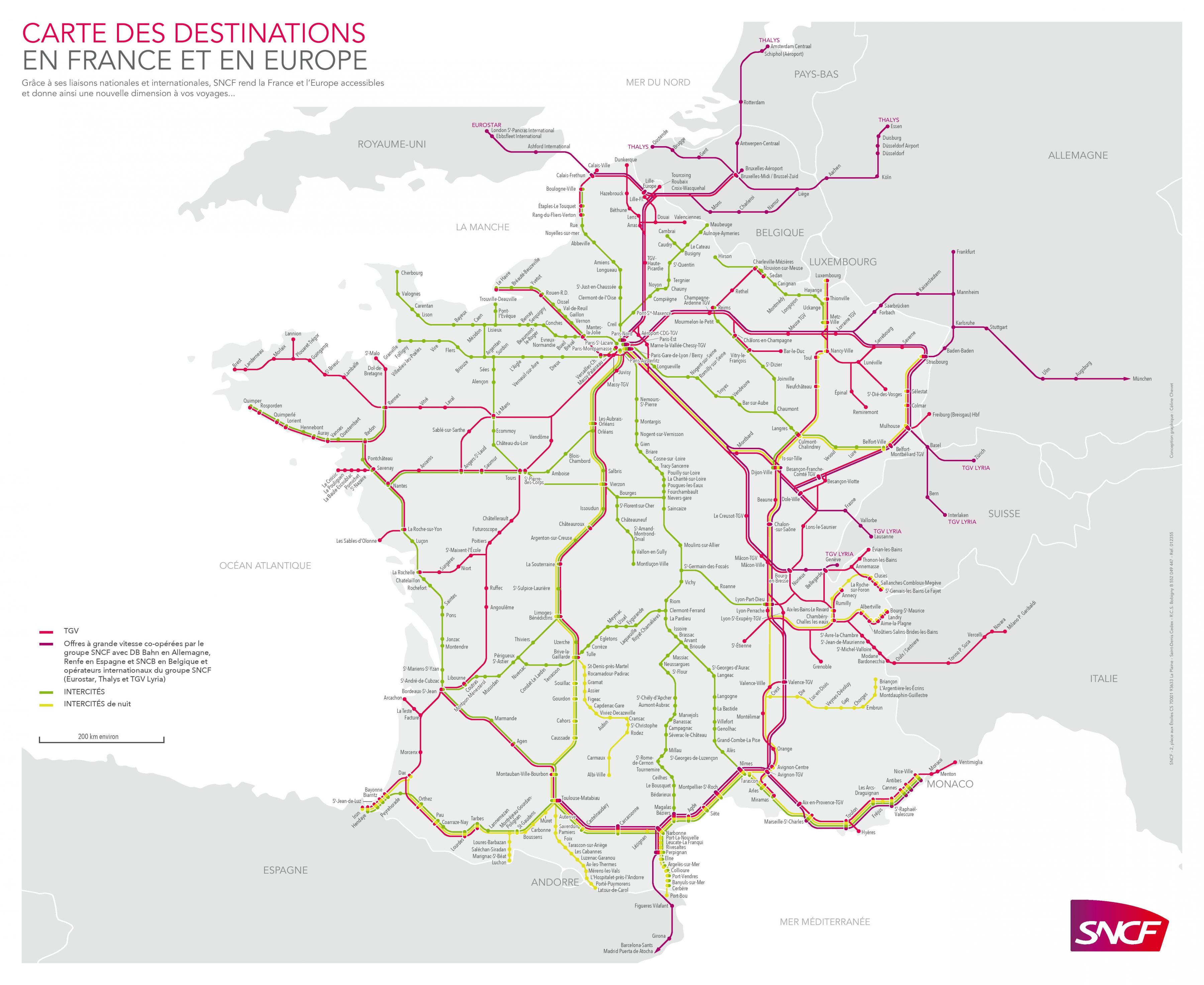
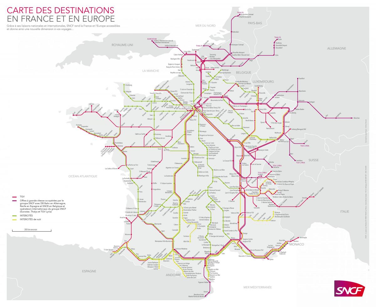
You can find on this page the France trains map to print and to download in PDF. The France railways map presents the rail network and shows high speed rails routes of France in Europe.
The France rail map shows all the railway stations and lines of France trains. This train map of France will allow you to easily travel by train in showing the major rail routes and high speed rail routes of France in Europe. The France rail map is downloadable in PDF, printable and free.
The French railway network, as administered by Réseau Ferré de France (RFF), disposes (June 2007) of a network of commercially usable lines as its mentioned in France rail map of 29,213 kilometers (18,152 mi), out of which 15,141 km (9,408 mi) is electrified. 1,876 km (1,166 mi) of those are high speed lines (LGV), 16,445 km (10,218 mi) dispose of two or more tracks. 5,905 km (3,669 mi) are supplied with 1,500 V DC, 9,113 km (5,663 mi) with 25 kV AC at 50 Hz. 122 km (76 mi) are electrified by third rail or other means.
France has an up-to-date rail system which includes abundant high-speed rail lines. Using the rail map below, you can find the major rail lines to plan your French vacation and get information on the rail passes available to the tourist in France. The France Rail Map shows the major rail routes in France. In a map of this scale, not all of the smaller lines can be included, but you should be able to plan your vacation using the lines shown here.
Nearly all rail network in France are run by the national SNCF (Société nationale des chemins de fer français) as you can see in France rail map. That covers everything from the regional TER trains linking small towns and cities to the faster IC (InterCité) trains on the longer-haul routes between major towns and cities (at night they become IN (InterCités de Nuit) to the high-speed TGV (Trains de Grande Vitesse) which zip along at 320kph between major cities in France and neighboring countries.