

You can find on this page the France road map to print and to download in PDF. The France driving map presents the detailed road network, main highways and free motorways of France in Europe.
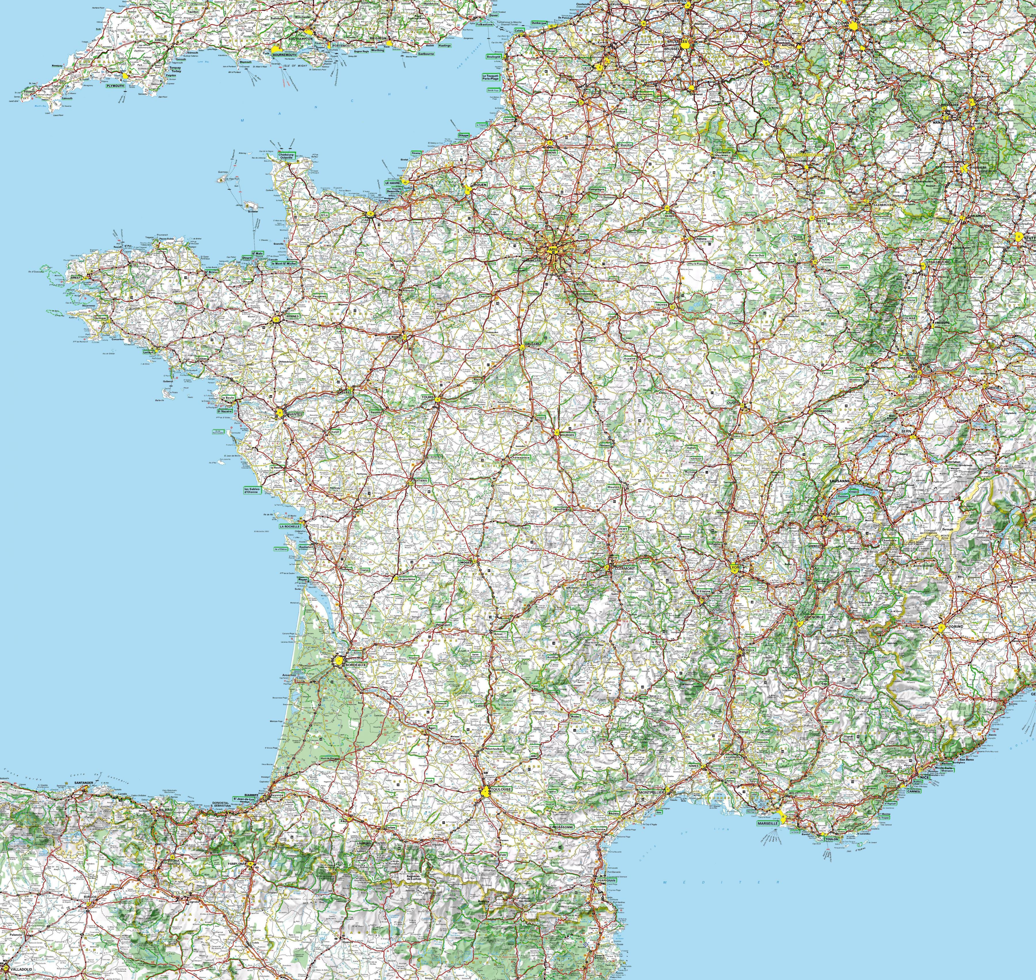
The France road map shows all roads network and main roads of France. This road map of France will allow you to preparing your routes and find your routes through the roads of France in Europe. The France roads map is downloadable in PDF, printable and free.
There are 1,000,960 km of roads in France as its mentioned in France roads map. The French motorway network or autoroute system consists largely of toll roads, except around large cities and in parts of the north. It is a network totalling 12,000 km (7,500 mi) of motorways operated by private companies such as Sanef (Société des autoroutes du Nord et de l'Est de la France).
France currently counts 30,500 km of major trunk roads or routes nationales and state-owned motorways as you can see in France roads map. By way of comparison, the routes départementales cover a total distance of 365,000 km. The main trunk road network reflects the centralising tradition of France: the majority of them leave the gates of Paris. Indeed, trunk roads begin on the parvis of Notre-Dame of Paris at Kilometre Zero. To ensure an effective road network, new roads not serving Paris were created.
A roads (as in A6) are motorways, called autoroutes in France. N roads are national strategic truck routes as its shown in France roads map. D roads are departmental (county) roads. They range from busy local routes and former national routes now downgraded (make sure you have an up-to-date map with the new road numbers) to tiny country lanes.

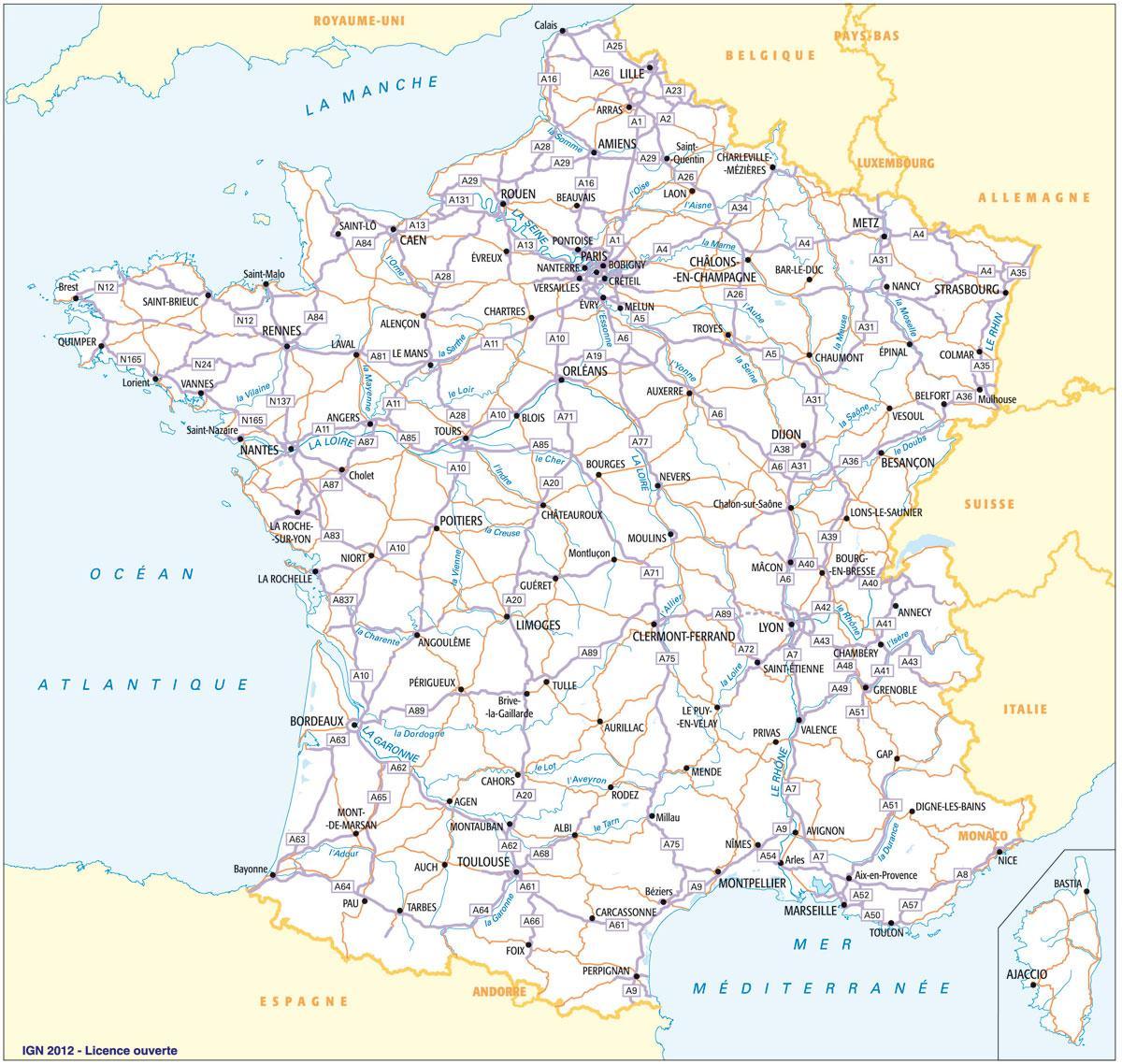
The France highway map shows toll and free motorways of France. This highways map of France will allow you to prepare your routes on motorways of France in Europe. The France highway map is downloadable in PDF, printable and free.
Travelling by car is a comfortable and efficient solution to visit France as the roads are well-maintained and the highway network is largely developed. In fact French motorways represent 8,000 kilometres of limited-access roads called "Autoroutes" (speed highways) in France as its mentioned in France highway map. It has the sixth largest highway network in the world, trailing only the United States, China, Canada, Spain and Germany.
The French highway network is run by several private companies as you can see in France highway map, this mainly explains why they are not free. The multiple tolls on the French autoroutes can be paid by credit card and cash, but now specific subscriptions and magnetic Travel Cards allow regular drivers like salesmen, lorry drivers and locals, to pay monthly with discounts.
A new highway connecting Castres and Toulouse is being planned in Southern France as its shown in France highway map. The tender process for the project is now opening, although the estimated cost of the construction work has yet to be released. The route will measure 54km and will help improve transport in the region.